With only one week to go until the start of the Tour de France 2010 it definitely became urgent to provide you, as usual with the different cycling races and most specially for the Tour de France, the Tour de France 2010 route on Google Maps/Google Earth!
In this article you'll find the time- and route schedules, the stage profiles and the route of each of the stages on Google Maps. At the end of this article you can also download a file which allows you to view the whole Tour de France 2010 route in Google Earth and, if you want to, to make a virtual fly-over over one or more stages just like you were there!
The Tour de France 2010 will take place from Saturday 3 till Sunday 25 July from Rotterdam (in The Netherlands) and the usual finish on the Champs-Elysées in Paris. The Grande Boucle will visit, after the start from The Netherlands, Belgium (with a visit of Brussels and with paved zones in the stage which finished in the north of France) before going around Paris on the east side and visit the Alps before the Pyrenees. In the Pyrenees the Tour will celebrate the 100th anniversary of the first Tour de France visit of this mountain chain, especially with the double climb of the Col du Tourmalet including one for a mountain top finish on Thursday 22 July. This 97th edition will end with a flat stage towards Bordeaux where the decisive individual time trial will take place the next day. After the transfer by TGV the riders will finally ride the shortest stage of the Tour de France since more than 20 years which connects Longjumeau to the finish on the Champs-Elysées in Paris in 102.5 kilometers (this distance includes the 8 rounds on the circuit on the Champs).
The 2010 Tour de France stages
Here you can find a table with the 21 stages of the Tour de France 2010: a prologue in Rotterdam and 20 stages. Click on each of the stages to get access to a short description of it, the stage profile, the route map on Google Maps and the corresponding time- and route schedules which indicate at what time the 97th edition of the Tour de France will visit each of the cities and villages on the Tour's route.| # | type | date | start | finish | distance |
|---|---|---|---|---|---|
| P | prologue (individual time trial) | Sa. 3 July 2010 | Rotterdam (NL) | Rotterdam (NL) | 8,9 km |
| 1 | flat | Su. 4 July 2010 | Rotterdam (NL) | Brussels (BE) | 223,5 km |
| 2 | hilly | Mo. 5 July 2010 | Brussels (BE) | Spa (BE) | 201 km |
| 3 | flat | Tu. 6 July 2010 | Wanze | Arenberg - Porte du Hainaut | 213 km |
| 4 | flat | We. 7 July 2010 | Cambrai | Reims | 153,5 km |
| 5 | flat | Th. 8 July 2010 | Epernay | Montargis | 187,5 km |
| 6 | flat | Fr. 9 July 2010 | Montargis | Gueugnon | 227,5 km |
| 7 | middle mountains | Sa. 10 July 2010 | Tournus | Station des Rousses | 165,5 km |
| 8 | high mountains | Su. 11 July 2010 | Station des Rousses | Morzine-Avoriaz | 189 km |
| R | repos | Mo. 12 July 2010 | Morzine-Avoriaz | ||
| 9 | high mountains | Tu. 13 July 2010 | Morzine-Avoriaz | Saint-Jean-de-Maurienne | 204,5 km |
| 10 | middle mountains | We. 14 July 2010 | Chambéry | Gap | 179 km |
| 11 | flat | Th. 15 July 2010 | Sisteron | Bourg-lès-Valence | 184,5 km |
| 12 | hilly | Fr. 16 July 2010 | Bourg-de-Péage | Mende | 210,5 km |
| 13 | flat | Sa. 17 July 2010 | Rodez | Revel | 196 km |
| 14 | high mountains | Su. 18 July 2010 | Revel | Ax-3 Domaines | 184,5 km |
| 15 | high mountains | Mo. 19 July 2010 | Pamiers | Bagnères-de-Luchon | 187,5 km |
| 16 | high mountains | Tu. 20 July 2010 | Bagnères-de-Luchon | Pau | 199,5 km |
| R | repos | We. 21 July 2010 | Pau | ||
| 17 | high mountains | Th. 22 July 2010 | Pau | Col du Tourmalet | 174 km |
| 18 | flat | Fr. 23 July 2010 | Salies-de-Béarn | Bordeaux | 198 km |
| 19 | individual time trial | Sa. 24 July 2010 | Bordeaux | Pauillac | 52 km |
| 20 | flat | Su. 25 July 2010 | Longjumeau | Paris - Champs-Elysées | 102,5 km |
The route on Google Maps, the stage profiles and the time- and route schedules for each of the stages of the 2010 Tour de France
CONTINUE READING AFTER THIS ADVERTISEMENT
P/ Saturday 3 July 2010 : prologue Rotterdam > Rotterdam - individual time trial - 8,9 km
On Saturday 3 July 2010, the Tour de France 2010 will start with an individual time trial in the center of the city of Rotterdam with its start on Zuidplein and finish not far from there on the Zuiderparkweg in front of the congress center Ahoy where the Permanence and the Press room will be as well.The route is almost completely flat (the route's going uphill only on the bridges which cross the Nieuwe Maas), time trial specialists will have a very good chance to take the lead of the general classification and thus battle for the first yello jersey of this 97th Tour de France. The only parameter they don't control ... is the wind!
Should the prologue be called first stage?
I have long time hesitated in my different articles about the Tour de France 2010 route to call this stage a prologue or first stage. Indeed, with its 8.6 kilometer distance (after the official announcement on 14 October 2009 some supports indicated "8 km" while others said "9 km"), it would normally not be possible to call this a prologue. Indeed, as indicated in the article 2.6.006 of title 2 - épreuves sur route - of the UCI rules for cycling a stage race can have a prologue only if its distance is under 8 kilometers (other conditions apply but those are respected here). It is therefore surprising that this stage can be called "prologue" ... If someone has the explanation, please let me know!
Below you'll find the time- and route schedule, the stage profile and the route on Google Maps for this stage. Click on each of these images to open them.


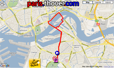
- City information
> After Amsterdam (1954, the first start abroad in the history of the Tour de France), Scheveningen (1973), Leiden (1978) and Den Bosch (1996), Rotterdam becomes the 5th city in The Netherlands to receive the Grand Départ of the Tour de France. - The programme
The prologue will start at 4.15PM and finish around 7.45PM. Indeed, the Football World Cup (FIFA) 2010 is currently ongoing and will end only on 11 July 2010 in South Africa. Since two quarter finals will take place on the same day, the first at 4PM and another one at 8.30PM and since The Netherlands could play the match at 8.30PM (if they get into the quarter finals), the Tour prologue must finish before.
The advertising caravan will start at 2.10PM and the programme will thus be as follows:
2.10PM : start advertising caravan
4.15PM : prologue start for the first rider (start every minute)
7.42PM : end of the prologue for the last rider
01/ Sunday 4 July 2010 : Rotterdam > Brussels - flat - 223,5 km
Just like the first stage of the 2007 Tour de France which started in London, the start of this stage will be on the Erasmusbrug. Before the riders arrive at this official start, they will have followed a nice circuit in the city center of Rotterdam.The stage quickly goes towards the coastline before it arrives in the Zealand province where the riders will most probably be exposed to a side wind, just like in the stage from Amsterdam to Middelburg in the 2010 Giro d'Italia. This wind will most probably lead to the formation of smaller groups and some riders could well be surprised (everyone knows this is the weak point of Alberto Contador (Astana)). However, not like in the Giro d'Italia 2010, this stage of the Tour de France 2010 will continue via Antwerp towards Brussels. Before the riders arrive in the finish city, they will visit the city Meise where Eddy Merckx lives to honour his 5 victories of the Tour de France.
Below you'll find the time- and route schedule, the stage profile and the route on Google Maps for this stage. Click on each of these images to open them.


- City informations / stage
> Rotterdam has received the Tour de France once before 2010: for the finish of stage 1a coming from Scheveningen and for the start of stage 1b towards Saint-Nicolas
> Brussels has received the Tour de France 9 times before 2010, for the last time in 1992 with the finish of a stage coming from Roubaix, won by Laurent Jalabert. This Belgian city is thus the foreign city which is on top of the list of cities which have most often received the Tour de France
This stage is made for sprinters (given that they should be in the right group at the finish if the wind has led to the formation of small groups) and will most probably be a very popular stage with many people on the sides of the road in The Netherlands and in Belgium where cycling is very popular!
2/ Brussels > Spa - 201 km
On Monday 5 July the stage will be 100% Belgian. After having honoured Eddy Merckx at the foot of the Atomium in Brussels, the riders will leave towards the thermal city Spa for a hilly stage of 192 kilometers.This stage contains 6 climbs (Côte de France (4), Côte de Filot (4), Côte de Werbomont (4), Côte d'Aisomont (3), Col de Stockeu (3), Col du Rosier (3)) and the last climb will be at 12 kilometers from the place where the finish line will be drawn in Spa (the Col du Rosier). The three intermediate sprints will be in Perwez (39,5 km), Seny (112 km) and Coo (177 km) while the feeding zone will be in Ampsin.
Below you'll find the time- and route schedule, the stage profile and the route on Google Maps for this stage. Click on each of these images to open them.


- City informations / stage
> In 1958, at the time of the Universal Exhibition, the Tour de France started in Brussels, for a stage towards Ghent
> Spa has received the Tour de France 3 times before 2010: in 1962 for a stage finish and start, in 1980 for a time trial on the Circuit of Spa-Francorchamps and in 1989 for a finish on this same circuit. The city is also known for its mineral water with the same name, competitor of one of the sponsors of the Tour de France, Vittel
After a first flat part in this stage, it will partly follow the routes of the spring classics with the Col du Rosier. However, this col will be climbed from the other side as for Liège-Bastogne-Liège.
This stage could well be won by a puncher ... unless they'll leave a chance for the sprinters to fight for the stage victory on the finish line.
3/ Wanze > Arenberg - Porte du Hainaut - 213 km
The 3rd stage of this 97th édition of the Tour de France will go from Wanze to Arenberg (Porte du Hainaut) over a distance of 213 kilometers.One of its particularities is that both the start and the finish city have never received the Tour de France before!
The other particularity of this stage is the come back of the cobble stone zones in the Tour de France: in 2004 the riders of the Tour passed on cobbled stones for the last time and this time they will see no less than 7 cobbled stones sectors over a total distance of 13.2 kilometers: in Belgium the Secteur pavé d'Ormeignies (350m), the Secteur pavé d'Hollain (1,2 km) and the Secteur pavé de Rongy (700 m).
In the 30 last kilometers, in France, they'll find the following 4 cobbled stones sectors: the Secteur pavé de Sars-et-Rosières (2,4 km), the Secteur pavé de Tilloy-lez-Marchiennes (2,5 km), the Secteur pavé de Wandignies-Hamage (3,7 km) and the Secteur pavé d'Haveluy (2,3 km) at a bit less than 10 kilometers from the finish in Arenberg.
On the route of this stage, the experts will most probably recognise some places which have become popular thanks to Liège-Bastogne-Liège!
The village départ of this stage will be built on the Place François Faniel in Wanze while the finish will be at the entrance of the Trouée d'Arenberg, known from Paris-Roubaix.
Below you'll find the time- and route schedule, the stage profile and the route on Google Maps for this stage. Click on each of these images to open them.


- City informations / stage
> Wanze: the Tour de France came through this city in July 2004 and the Giro started here in 2006, Wanze will receive for the first time the start of a Tour de France stage in 2010!
Cycling fans most probably know the city of another cycling classic organised by A.S.O., the Flèche Wallonne which finishes close to Wanze, at the Mur d'Huy.
> Arenberg also receives the Tour de France for the very first time but its trouée, which is officially called the Drève des Boules d'Hérin, has already so many times had a decisive role in Paris-Roubaix that Arenberg is not unknown in the cycling world!
CONTINUE READING AFTER THIS ADVERTISEMENT
04/ Wednesday 7 July 2010 : Cambrai > Reims - flat - 153,5 km
After an original start (prologue in Rotterdam, first stage following the coast line, second stage in Belgium and third stage remembering the spring classics) the Tour de France 2010 continues with a more classical fourth stage.Over a distance of only 153.5 kilometers, the riders will connect the north of France, Cambrai, with the champagne capital, Reims.
The only difficulty of the day is the Côte de Vadencourt (4) after 40.5 kilometers while the sprinters can take some points for the classification by points in Walincourt-Selvigny (12.5 km), Flavigny-et-Beaurin (49.5 km) and in Brienne-sur-Aisne (128.5 km). The feeding zone will be in Housset.
Below you'll find the time- and route schedule, the stage profile and the route on Google Maps for this stage. Click on each of these images to open them.


- City informations / stage
> Cambrai : this city will in 2010 be a Tour stage start city for the second time, after a first start in 2004 for a stage towards Arras. 6 years ago that was a 60 kilometer long stage which was run as a team time trial, won by the US Postal team and thus allowing Lance Armstrong to take back the yellow jersey from Robbie McEwen.
> Reims : the champagne capital receives the Tour more often, ten times already! The last time was in 2002 when Robbie McEwen won the stage after a sprint. - Visited departments : Nord (59), Aisne (02), Ardennes (08), Marne (51)
5/ Épernay > Montargis - 187,5 km
After the previous stage most probably ending in a sprint, this stage between Épernay and Montargis is most probably also made for sprinters.At the start of the stage the riders will find two 4th category climbs: the Côte d'Orbais-l'Abbaye (18.5 km) and the Côte de Mécringes (36.5 km). In between the two will be the first intermediate sprint in Vauchamps (27.5 km) while after the feeding zone in Donnemarie-Dontilly they'll find two other sprints, in Ville-Saint-Jacques (126.5 km) and in Préfontaines at 21 kilometers from the finish.
This stage will pass through the stage start city of the last stage of the Tour de France 2009, Montereau-Fault-Yonne.
Below you'll find the time- and route schedule, the stage profile and the route on Google Maps for this stage. Click on each of these images to open them.


- City informations / stage
> Épernay : après Reims, on continue dans les capitales du champagne avec Épernay. La ville a reçu le Tour à 3 reprises avant 2010, pour une arrivée en 1963 (stage remportée par le belge Eddy Pauwels qui prenait au passage également le maillot jaune à l'arrivée à Épernay) et deux fois pour un départ d'stage (1978 et 2002).
> Montargis : this city has received the Tour 3 times already: with a sprint finish (won by Herman van Springel) and a stage start towards Créteil in 1969, with a stage start towards Versailles in 1976 and in 2005 for another sprint finish in a stage won by Robbie McEwen.
In 2010, Montargis will be both finish and start city, just like in 1969 - Visited departments : Marne (51), Seine-et-Marne (77), Loiret (45)
6/ Friday 9 July 2010 : Montargis > Gueugnon - flat - 227,5 km
The stage between Montargis and Gueugnon is the longuest stage of this 97th Tour de France. With its 225 kilometers this is a relatively flat stage with only some short hilly parts. A perfect stage for a long escape or ... for a sprint finish!Below you'll find the time- and route schedule, the stage profile and the route on Google Maps for this stage. Click on each of these images to open them.


- City informations / stage
> Montargis : see above
> Gueugnon : this city in Saône-et-Loire will receive the Tour de France for the very first time in 2010. The supporters of the Football Club de Gueugnon, which contributed to the name of the city being known everywhere in France, the Gueugnonnais and Gueugnonnaises will thus discover the biggest annual sports event on the finish line of this stage - Visited departments : Loiret (45), Yonne (89), Nièvre (58), Saône-et-Loire (71)
7/ Saturday 10 July 2010 : Tournus > Station des Rousses - middle mountains - 165,5 km
This Saturday, it's time for the first middle mountains stage of this Tour de France with the Côte de l'Aubépin (3), the Côte des Granges (4) and the Côte d'Arinthod (3) before 3 climbs of the 2nd category: the Côte du barrage de Vouglans, the Col de la Croix Serra and finally the Côte de Lamoura at 4 kilometers from the finish.Below you'll find the time- and route schedule, the stage profile and the route on Google Maps for this stage. Click on each of these images to open them.

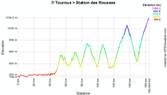

- City information / stage
> Tournus : this city in Saône-et-Loire has never received the Tour de France before but the stage start for the Critérium du Dauphiné Libéré in 2009 was most probably the first sign of the love of the Tournusiens for cycling
> Station des Rousses : for the Station des Rousses this Tour de France 2010 stage finish is also a first timer and as such, the ski station is lucky because it will have a stage finish in Lamourra on Saturday 10 and a stage start in Bois d'Amont the next day - Visited departments : Saône-et-Loire (71), Ain (01), Jura (39)
CONTINUE READING AFTER THIS ADVERTISEMENT
8/ Sunday 11 July 2010 : Station des Rousses > Morzine-Avoriaz - high mountains - 189 km
The day before the first rest day, this 8th stage is the first high mountains stage which includes the following first category climbs at the end of the stage: the Col de la Ramaz and the mountain top finish in Morzine-Avoriaz, and of course at the start of the stage the Côte de la Petite Joux (4), the smaller Côte de Grésin and between the two first category climbs the climb of Les Gets (3). This stage turns around Switzerland and the city of Genève.Below you'll find the time- and route schedule, the stage profile and the route on Google Maps for this stage. Click on each of these images to open them.

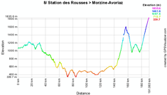

- City informations / stage :
> Station des Rousses : see above
> Morzine-Avoriaz : not like the Station des Rousses, Morzine-Avoriaz knows the Tour de France since a long time because la Grande Boucle has already made a stop here 23 times: 17 times in Morzine and 6 times in Avoriaz including at the end of the 70's several mountain time trials - Visited departments : Jura (39), Ain (01), Haute-Savoie (74)
R/ Monday 12 July 2010 : first rest day - Morzine-Avoriaz
After these two first mountain stages and before continuing several other mountain stages in the second week of the Tour de France 2010, the first rest day is planned in Morzine-Avoriaz on Monday 12 July.9/ Tuesday 13 July 2010 : Morzine-Avoriaz > Saint-Jean-de-Maurienne - 204,5 km
After the well-deserved first rest day, the riders will connect Morzine-Avoriaz to Saint-Jean-de-Maurienne, the other way around as for the stage which took place between those two cities in 2006 over 204.5 kilometers.In this second high mountains stage, the riders will climb quickly after the start from Morzine the Côte de Châtillon (4) before continuing the three following climbs: the Col de la Colombière (1), the Col des Aravis (2) and the Col des Saisies (1). In this last climb, the riders will find the feeding zone in Mont-Rond. At 32 kilometers from the finish they'll find the top of the last climb of the day, which is quite impressive since it's the Col de la Madeleine (HC).
Below you'll find the time- and route schedule, the stage profile and the route on Google Maps for this stage. Click on each of these images to open them.


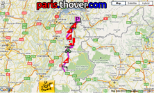
- City informations / stage :
> Morzine-Avoriaz : see above
> Saint-Jean-de-Maurienne : as I said before, Saint-Jean-de-Maurienne already received the Tour de France once before this stage finish in 2010, for a stage start in the other direction in 2006 - Visited departments : Haute-Savoie (74), Savoie (73)
10/ Wednesday 14 July 2010 : Chambéry > Gap - 179 km
The start of this middle mountains stage between Chambéry and Gap is quite flat, until kilometer 65 where the climb of the Côte de Laffrey (1) starts. After the feeding zone in Pierre-Châtel the riders will continue with the climb of the Côte des Terrasses (3). In the last third part of the stage they'll climb the Col du Noyer (2).Below you'll find the time- and route schedule, the stage profile and the route on Google Maps for this stage. Click on each of these images to open them.

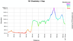
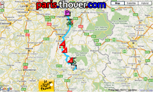
- City informations / stage :
> Chambéry : the city where the AG2R La Mondiale team is based is used to receive the Critérium du Dauphiné Libéré but has received the Tour de France only once before 2010, also for a stage start, towards Les Arcs
> Gap : the city of Gap is more used to receive the Tour de France since it has already been 19 times stage city with several stage starts and finishes. The last time was in 2006 when the city saw the stage finish coming from Montélimar and with the riders leaving the next day towards the Alpe d'Huez - Visited departments : Savoie (73), Isère (38), Hautes-Alpes (05)
CONTINUE READING AFTER THIS ADVERTISEMENT
11/ Thursday 15 July 2010 : Sisteron > Bourg-lès-Valence - flat - 184,5 km
Between Sisteron and Bourg-lès-Valence the sprinter's teams will most probably again control the race because since the stage's only difficulty is a 3rd category climb only and since it's in the first half of the stage (the Col de Cabre) they will have plenty of time to get organised for a spritn final over a one kilometer long finish line.Below you'll find the time- and route schedule, the stage profile and the route on Google Maps for this stage. Click on each of these images to open them.

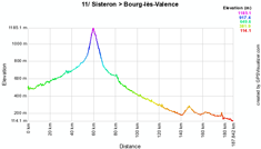
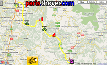
- City informations / stage :
> Sisteron : the Sisteronais are used to see the riders of the Race to the sun, Paris-Nice, but this is the first time that the Tour de France stops at the foot of the Rocher de la Baume which will probably be shown in some nice images on TV
> Bourg-lès-Valence : in the shadow of Valence, Bourg-lès-Valence is also a city where the Tour de France never stopped before. 14 years after the only Tour stage in Valence this will now change. The city saw the riders in 2009 in their individual time trial of the Critérium du Dauphiné Libéré and is one of the rare cities to communicate a map with the hours on which different routes will be closed around the official route on the dedicated page on its website - Visited departments : Alpes-de-Haute-Provence (04), Hautes-Alpes (05), Drôme (26),
12/ Friday 16 July 2010 : Bourg-de-Péage > Mende - hilly - 210,5 km
This 12th stage proposes a bit more relief with 3 climbs of the 3rd category (the Côte de Saint-Barthélemy-le-Plain, the Col des Nonières and the Côte de la Mouline) completed with the climb of the Suc de Montivernoux (2) in the middle of the stage and the mountain top finish at the Côte de la Croix Neuve / Montée Laurent Jalabert.The feeding zone will be just after the top of the Suc de Montivernoux in Lachamp-Raphaël.
Below you'll find the time- and route schedule, the stage profile and the route on Google Maps for this stage. Click on each of these images to open them.

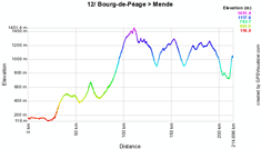
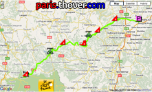
- City informations / stage :
> Bourg-de-Péage : yet another stage city which has never received the Tour de France: Bourg-de-Péage also already saw the professional peloton with the Critérium du Dauphiné Libéré.
> Mende : for Mende the Tour is not new because in 1995 already the city received a stage finish and -start, before the stage finish coming from Albi in 2005.
At the finish in 1995 Laurent Jalabert won the stage on top of the climb which now has its name since 2005 as an honour to this victory. Alberto Contador was recently won there during Paris-Nice 2010, just like in 2007 when the Race to the Sun already made a stop there. A sign for the future winner of the 12th stage of the Tour de France 2010? - Visited departments : Drôme (26), Ardèche (07), Haute-Loire (43), Lozère (48)
13/ Saturday 17 July 2010 : Rodez > Revel - flat - 196 km
On Saturday 17 July the sprinters will probably realise that they don't have many chances to win a stage anymore and since the small climbs in this stage (the Côte de Mergals (4), the Côte de Bégon (4), the Côte d'Ambialet (3) and the Côte de Puylaurens (4)) and even the Côte de Saint-Ferréol at 7.5 kilometers from the finish will not stop them from getting organised for a bunch sprint.Below you'll find the time- and route schedule, the stage profile and the route on Google Maps for this stage. Click on each of these images to open them.

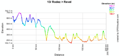
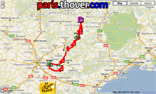
- City informations / stage :
> Rodez : the last time the Tour de France stopped in Rodez was in 1984 when Vincent Barteau wore the yellow jersey
> Revel : for Revel the Tour has no secrets anymore since the city at the foot of the Montagne Noire and close to the Lac de Saint-Férréol has been stage city 8 times already - Visited departments : Aveyron (12), Tarn (81), Haute-Garonne (31)
14/ Sunday 18 July 2010 : Revel > Ax-3 Domaines - high mountains - 184,5 km
After having offered the sprinters their last chance to win a stage, on Sunday 18 July the climbers will again be in the lead. The start of the stage is relatively flat but after 130 kilometers the climb of the Port de Pailhères (HC) starts. After the descent of this 15.5 kilometer long climb with an average slope of 7.9% they immediately continue with the climb towards the mountain top finish in Ax-3 Domaines.Below you'll find the time- and route schedule, the stage profile and the route on Google Maps for this stage. Click on each of these images to open them.

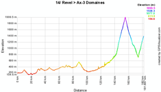

- City informations / stage :
> Revel : see above
> Ax-3 Domaines : the Tour stopped 3 times before (since 2001) in this ski station. The record for the climb towards the Plateau de Bonascre is currently held by the winner of the 2008 Tour de France, Carlos Sastre. He did this climb from Ax-les-Thermes in 22'30" and thus with an average speed of 21.067 km/h - Visited departments : Haute-Garonne (31), Aude (11), Ariège (09)
CONTINUE READING AFTER THIS ADVERTISEMENT
15/ Monday 19 July 2010 : Pamiers > Bagnères-de-Luchon - high mountains - 187,5 km
After the start from Pamiers the riders of the Tour de France 2010 will climb some hils in the first part of the stage, including the Côte de Carla-Bayle (4) before continuing towards the feeding zone in Aucazein on the climb of the Col de Portet-d'Aspet (2), and than the Col des Ares (2) and finally the Port de Balès (HC). After the descent of this last climb, the riders will find the finish line in Bagnères-de-Luchon.Below you'll find the time- and route schedule, the stage profile and the route on Google Maps for this stage. Click on each of these images to open them.

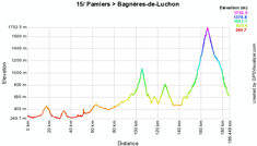
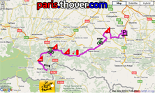
- City informations / stage :
> Pamiers : it might sound surprising but the city Pamiers has never before received the Tour de France and it's thus not quite surprising that the city organises several events around this stage start. These events can be consulted at the dedicated page to the Tour de France 2010 on Pamier's site, just like the information about the routes being closed in the city
> Bagnères-de-Luchon : this city, at that time called Luchon, was the first finish city of a Pyrenean stage in the Tour 100 years ago! Since then, the Tour de France went back there no less than 50 times. - Visited departments : Ariège (09), Haute-Garonne (31), Hautes-Pyrénées (65)
16/ Tuesday 20 July 2010 : Bagnères-de-Luchon > Pau - high mountains - 199,5 km
The next day the historical city for the Tour will also be the start city for a mountain stage with two first category climbs (Col de Peyresourde and Col d'Aspin) followed by two hors category climbs: the Col du Tourmalet and at the end of the second half of the stage the Col d'Aubisque at about 60 kilometers from the finish. The feeding zone is between the Tourmalet and the Aubisque in Soulom.This will be the first part of the tribute to the Col du Tourmalet, the mythical climb which was part of the first Pyrenean stage in the history of the Tour. Since 1910, the Tour passed more than 75 times (which makes it the most climbed mountain of the Tour). Since these two hors category climbs are located quite far from the finish, the winner of this stage might well come from a rider in a leading group rather than the best climbers on this mountain. In an answer to the critics on the distance between the Tourmalet and the finish in Pau, A.S.O. answered laconically and with humour : Some say that it will not bring anything to how the race develops. The only thing is neither Pau nor the Col du Tourmalet have changed place, and everything depends on the race. The riders will have to tackle Peyresourde from the start, Aspin, Tourmalet and Aubisque. Admittedly, the Aubisque pass is 60 kilometres from the finishing line, but it is followed by 30 kilometres of descent before getting to grips with the valley bottom. It is the same route (except that the stage finish was in Mourenx) as in 1969 when Eddy Merckx was victorious after a 180-kilometre breakaway. We wanted to make this stage a little tribute to him.
Below you'll find the time- and route schedule, the stage profile and the route on Google Maps for this stage. Click on each of these images to open them.

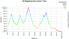

- City informations / stage :
> Bagnères-de-Luchon : voir above
> Pau : in Pau the Tour de France is really not unknown. Indeed, after Paris and Bordeaux, this is the third city in the ranking of the cities which have most often received the Grande Boucle (since its first visit in 1930) : 2010 will be the 63rd time. Often, just like in 2010, a finish in this city is linked to a rest day. - Visited departments : Haute-Garonne (31), Hautes-Pyrénées (65), Pyrénées-Atlantiques (64)
R/ Wednesday 21 July 2010 - rest day - Pau
The riders will spend the second rest day in Pau, as usual on several previous Tour de France editions.17/ Thursday 22 July 2010 : Pau > Col du Tourmalet - high mountains - 174 km
After the well-deserved rest the riders will continue with a new high mountains stage: after the small Côte de Renoir (4th) at the start of the stage, they'll climb the Col de Marie-Blanque (1) of which the top is reached after less than 60 kilometers already, the Col du Soulor after the feeding zone in Asson and finally the climb towards the mountain top finish on top of the Col du Tourmalet (HC).There have been 3 stage finishes in the climb, in La Mongie, but this stage will only be the second one in the history of the Tour de France with a stage finish on top of this mountain. This will probably recall some nice souvenirs for Jean-Pierre Danguillaume (who now works in the Tour) since he won the first stage with finish here in 1974.
This stage will also be L'Etape du Tour and the route map on Google Maps and the stage profile thus also apply to this race.
Below you'll find the time- and route schedule, the stage profile and the route on Google Maps for this stage. Click on each of these images to open them.


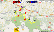
- City informations / stage :
> Pau : see above
> Col du Tourmalet : this is thus, after 1974, the second mountain top finish on the most climbed mountain of the Tour de France - Visited departments : Pyrénées-Atlantiques (64), Hautes-Pyrénées (65)
CONTINUE READING AFTER THIS ADVERTISEMENT
18/ Friday 23 July 2010 : Salies-de-Béarn > Bordeaux - flat - 198 km
After all those mountain stages, the stage on Friday 23 July will be a new occasion for the sprinters who managed to get through the Pyrenees without too much trouble for a new stage victory with it's ... completely flat route.Below you'll find the time- and route schedule, the stage profile and the route on Google Maps for this stage. Click on each of these images to open them.


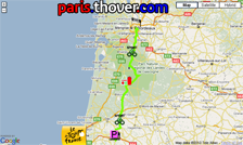
- City informations / stage :
> Salies-de-Béarn : people living in this city probably don't remember the last time the Tour de France visited them because that was ... way back in 1939, the only time the race stopped here!
> Bordeaux : for the city Bordeaux it's completely the oppostie ... the Grande Boucle has been there no less than 79 times before 2010 and Bordeaux is thus the second city in the ranking of cities which have most often received the Tour de France - Visited departments : Pyrénées-Atlantiques (64), Landes (40), Gironde (33)
19/ Saturday 24 July 2010 : Bordeaux > Pauillac - individual time trial - 52 km
It's only on the forelast day of the Tour de France 2010 that the first and only time trial of this 97th edition of the Tour de France (except for the prologue) is planned. After a quite long circuit in the streets of Bordeaux, the riders will continue their solitary effort in the wineyards of the Haut Médoc coming by numerous castles. According what people told me, this route is really great to see!Below you'll find the time- and route schedule, the stage profile and the route on Google Maps for this stage. Click on each of these images to open them.


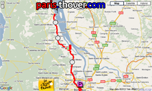
- City informations / stage :
> Bordeaux : see above
> Pauillac : for Pauillac this is the very first time the Tour de France stops in this Médoc city - Visited departments :
20/ Sunday 25 July 2010 : Longjumeau > Paris - Champs-Elysées - flat - 102,5 km
With its 102.5 kilometers (that includes the 8 rounds on the circuit of the Champs-Elysées), this last stage of the Tour de France 2010 is the shortest stage of the Grande Boucle since 20 years: except for exceptional conditions which obliged the organisers to shorten a stage, the last stage to be shorter than this one was the one between Bourg d'Oisans and Villard-de-Lans in 1989 with its 91.5 kilometers.As usual the stage finish on the Champs-Elysées will probably be a sprint. Last year, before its finish in Paris, it didn't visit Issy-les-Moulineaux, but this year the race will again visit A.S.O.'s new head offices on the Quai de la Bataille de Stalingrad (the riders will turn left on the round about at the foot of A.S.O.'s building).
Below you'll find the time- and route schedule, the stage profile and the route on Google Maps for this stage. Click on each of these images to open them.


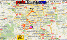
- City informations / stage :
> Longjumeau : in 2010, this city in the Essonne will receive the Tour de France for the first time
> Paris : the French capital is used to receive the finish of the last stage of the Tour de France, since 1975 on the Champs-Elysées - Visited departments : Essonne (91), Hauts-de-Seine (92) and Paris (75)
The 2010 Tour de France route downloadable in Google Earth
Above you have discovered the details of all stages of this 97th Tour de France including the time- and route schedules and the stage profiles and for each of them the route on Google Maps.If you would like to see the complete parcours of the Tour de France 2010, you can download the file below and open it in Google Earth.
>> Download the 2010 Tour de France route in Google Earth
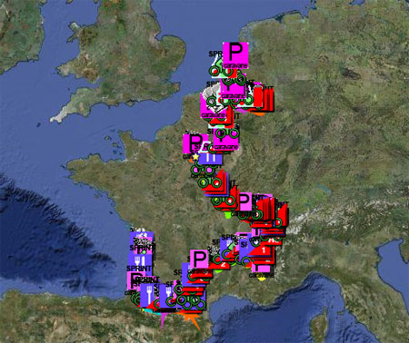
This file will not only allow you to see the full route in Google Earth, but also to do a virtual fly-over over the route of one or more of the stages. To do so, you can of course use the default settings of Google Earth, but if you want to do a fly-over which really gives you the idea you were on your bike riding on the roads of the 2010 Tour de France, I recommend you the following settings: in the menu Tools > Options choose the tab Touring and fill in the following choices on that tab:
- Camera tilt angle : 80.0 degrees
- Camera range : 150.0 meters
- Speed : 500.0 (if this makes you feel dizzy or if your computer or Internet connection don't allow you to get clear images with these settings, you can try lowering the speed) door Thomas Vergouwen
Vond u dit artikel interessant? Laat het uw vrienden op Facebook weten door op de buttons hieronder te klikken!
23 comments | 138142 views
this publication is published in: Tour de France | Tour de France 2010 | OpenStreetMap/Google Maps/Google Earth


 by marco1988 over
wouah quel boulot..!! félicitation Thomas pour toutes ces précisions..!
j ai hâtes d être au 7.........REIMS!!!
Merci Nathalie ! Tu as bien vu effectivement que c'est un boulot énorme ... et là je suis encore sur les traductions EN et NL ;-).
Le 7 je serai avec nos clients à Reims assez tôt, donc on aura sans doute l'occasion de se voir ! :-)
j y compte bien , René m attend a Reims aussi..!! et j espère aussi voir JAJA..!!
Bon courage pour les traductions..il est clair que tu es vraiment un vrai passionné qui en plus se défonce pour avoir un site aussi clair et précis..!! chapeau Mr tonton Thomas..!c est un plaisir de te lire!!
http://www.cyclisme-roltiss-over.com/article-le-parcours-du-tour-de-france-2010-sur-google-maps-53015105.html
Bonsoir Thomas,
D'abord félicitations pour le temps que vous mettez à faire toutes les étapes du tour sur Google Earth. Vous vous rapprochez de la perfection et je vais vous dire pourquoi. J'ai passé un peu de temps sur les tracés des 7 premières étapes. J'ai tout de même noté deux erreurs.
Une sur l'étape d'Arenberg, elle concerne le premier secteur en France, celui de Tilloy. Vous faites démarrez le secteur au Haut Marais à hauteur de la Haute Rue. Il faut le faire démarrer à hauteur de la Rue du Marais à Chênes. Il y a un picto photo qui l'indique.
Une sur l'étape des Rousses. Dans l'ascension vers Lamoura, vous faites arrêtez l'étape à la sortie de la ville, au sommet de la côte. Or d'après le roadbook, l'arrivée se situerait quelque part à La Combe du Lac, environ trois kilomètres plus loin.
Voilà,
Bravo ceci dit
Très très beau travail, ça nous permet de le refaire en voiture :D
ahhhh non..! pas en voiture a vélo...!!lol
@Yas94 : merci pour ces précisions ! Pour les secteurs pavé c'est toujours difficile malheureusement de bien les trouver. J'ai fait au mieux mais je vous fais confiance si vous dites qu'il y a une petite erreur ! Pour Lamourra je n'étais effectivement pas sûr, mais c'était pas très clair. Du coup, l'arrivée n'est pas vraiment à Lamourra alors ... ;-)
Malheureusement je risque de ne pas vraiment avoir le temps de corriger ces deux points ... si je trouve un moment je le ferai, mais là pour l'instant ça risque d'être chaud !
@Pronostics : perso je préfère le vélo comme Nath :D
Hola,
Muchas gracias y VIVA el Tour...
Thomas bedankt voor de mooie presentatie voor de wegbeschrijving om te volgen op google maps zal er iedere dag gebruik van maken als ik aan het kijken ben en aan uw prachtig werk denken ( JE moet het maar doen hee ) merci groetjes Yvan Belgie
Hallo, Ik probeer de instellingen te volgen die je aangeeft. Bij Extra zie ik geen Opties staan. Alleen Lineaal, GPS en Vluchtsimulator. Verder prachtig
Thomas,I have used your .kml files in the past,but the TDF2010 file is only 500 bytes, and does not seem to work correctly...am I doing something wrong? Best regards, Shawn Morrissey
@xil & @yvan: you're welcome, happy to see you like it!
@Zeezicht: heb je de laatste versie van Google Earth? Ik zit op dit moment in de Tour dus helaas weinig tijd om dat verder uit te zoeken ...
@Shawn: the small kml file is actually a network link to the full kml file; if you use it in Google Earth for example, it should automatically load the full kml file from there. In any other case, check out the link which is in the KML file and use that one. Hope this helps!
Dag Thomas, Als altijd weer prachtig gedaan. Hartelijk dank.
An excellent supply of useful information.
Very, very good!
Many thanks, R.
merci beaucoup pour toute les infos mais je ne comprend pas tres bien l'horaire a laquelle passe la caravane du tour pour demain a blanquefor j'aimerais emmené mon fils.
MERCI POUR LA REPONSE ET ENCORE FELICITATION POUR LE TRAVAIL
hai thomas ik ben pas 7 maar toch ben ik wel een google fan maar ik heb geen account
groeten mika
@mika: bedankt voor je berichtje ... Je hebt geen account nodig om de Tour op Google Maps (rechtstreeks op deze site) of in Google Earth te bekijken. Wel moet je eventueel Google Earth hier downloaden als je dat nog niet hebt gedaan.
Laat even weten of het gelukt is!
thomas goed nieuws het staat op mamma s computer
en ik heb giro d italia gedaan tour de france en la vuelta dus ik heb het wel gedaan groeten mika
p.s ik heb een nieuwe kamer gekregen maar de onderdelen komen uit duisburg en het matras komt uit haarlem ofzo en het is een sultan hamvimk en ook 7 + 3 = 10
hai thomas ik ben dat kind die de naam heeft mika ben ik zelf maar nu met achternaam dus maar dat progamma van dat google earht al lang gedownload en die spam dat zijn sommen die zijn kindermakkelijk vind je niet nou doeii!!!!!
p.s in me laatse bericht staat dat iik een nieuw bed heb
groeten mika
@Thomas Vergouwen ik ben op pakjesavond 8 geworden yeahhhh ik weet wat de auto van het jaar 2011 is : nissan leaf die is mooi nou doeii
une vue d'ensemble du tour de France
° ±»µ Counter Strike, ±» » °» »µ ¶µ AC Milan ±»° 58 ° ACDC, ±µ»° ±»° ° ACDC, , ±»° lineage 2 CS GO, ±»° ¶µ° ¶µ ACDC.
- ±»° µ»° ° »° ACDC µ° ±»° µ± Counter Strike.