The Giro d'Italia 2025 is just behind us, with its surprise ending in overall victory for Simon Yates (Team Visma | Lease a Bike), and the Critérium du Dauphiné 2025 is already on the horizon!
This Sunday, the big names in cycling (Jonas Vingegaard [Team Visma | Lease a Bike], Tadej Pogačar [UAE Team Emirates XRG] and Remco Evenepoel [Soudal Quick-Step]) will be at the start of this mini Tour de France in Domérat (just outside Montluçon, where the first stage will finish) for an 8-stage race (including a time trial) with a total distance of almost 1,200 km. And it will be the very last race in the career of Romain Bardet (Team Picnic PostNL)!
In this article, discover the detailed route of the Critérium du Dauphiné 2025 on OpenStreetMap maps and in Google Earth, as well as stage profiles and itinerary schedules.
The detailed route of the Critérium du Dauphiné 2025 on OpenStreetMap, along with stage profiles and itinerary schedules
CONTINUE READING AFTER THIS ADVERTISEMENT
The complete route has already been available on the velowire mobile app for a week!
If you're lucky enough to have an Android smartphone, you can already download the velowire app, which is available - for the time being on test - in the Play Store (before publication for iPhone/iPad in the App Store to come! - 💡do you have an iPhone or iPad? 📲Register now to be the first to test the application on iOS!)
Discover exclusive maps in the application that you can view full screen, while displaying your location on the same map, to find your way around the stage route!
Let's now look at the stages of the Critérium du Dauphiné 2025 one by one and in detail!
1/ Sunday June 8, 2025 - Domérat > Montluçon - 195.8 km
At the start of the first stage of the Critérium du Dauphiné 2025 in Domérat, the riders will already be very close to the finish, but they will cover no less than 195.8 kilometers before crossing the finish line for good. Definitely, in fact, as there will be several crossings of the finish line before the winner of this stage, and therefore the first wearer of the yellow and blue leader's jersey in the overall race classification, is known. First they'll head north towards Saint-Amand-Montrond, where they won't arrive after all, as they'll stay in the Allier department throughout this stage. The first part of the stage is fairly hilly throughout, but there are no difficulties for the best climber classification in the first half of the stage.As they approach the finish, they will find the first two difficulties of the stage, the Côte de Sainte-Thérence (4th category, 2.6 km at 4.6%) and the Côte d'Argenty (4th category, 2.1 km at 5.4%), before entering the final circuit, where other difficulties await them. First they go north into Montluçon, before retracing their steps on a parallel road and climbing the Côte de Buffon (4th category, 600 m at 8.6%). They then go back north into Montluçon, where they cross the finish line for the first time and contest the stage's intermediate sprint. Two more laps of a 31.8 km circuit then await them, taking them back to Domérat, close to the start line, before finding another difficulty, the Côte de Domérat (4th category, 1.9 km at 4%) before returning via Quinssaines and Prémilhat to the entry point on this circuit. They then climb the Côte de Buffon again, before crossing the finish line in Montluçon once more and completing a second lap of the circuit.
Below you'll find the time schedule, profile and OpenStreetMap map of the 1st stage of the Critérium du Dauphiné 2025. Click on images to enlarge.


2/ Monday June 9, 2025 - Prémilhat > Issoire - 204.6 km
Still close to Montluçon, the 2nd stage of the Critérium du Dauphiné 2025 will start in Prémilhat (where yesterday's final circuit passed). This time, it will be a more classic road stage (with just a slightly surprising route to the actual start), heading south-east on a slightly hilly course.From the actual start, the road rises, but the first real difficulty is to be found just over thirty kilometers away, on the Côte de la Font Nanaud (4th category, 3.5 km at 4.6%) and after a small, unreferenced intermediate climb, the riders will then find a triptych of climbs with the Côte de Saint-Priest-des-Champs (4th category, 1.3 km at 5%), the Côte des Rivauds (3rd category, 3.5 km at 4.8%) and the Côte de Saint-Jacques d'Ambur, also 3rd category (3 km at 5.1%).
A little further on, they will contest the intermediate sprint at Olby, and after another unreferenced climb, they will then first go through a downhill section, before finding the Côte du Château de Buron (2nd category, 3.3 km at 6.9%), just before arriving on the final circuit of this stage. Turning right, they then pass the finish line very quickly, before pushing south to Saint-Germain-Lembron and Vichel before starting the return journey to the finish town. They pass the Côte de la Nonette (4th category, 1.8km at 5.7%) before continuing on towards the entry point to the circuit, and therefore fairly soon after ... the finish in Issoire.
Below you'll find the time schedule, profile and OpenStreetMap for stage 2 of the Critérium du Dauphiné 2025. Click on images to enlarge.


3/ Tuesday June 10, 2025 - Brioude > Charantonnay - 207.2 km
Stage 3 of the Critérium du Dauphiné 2025 is the first to climb above 1,000 meters, and it starts right from the start in Brioude. The climb up the Côte de Cornille (3rd category, 4.1 km at 4.8%) begins almost as soon as the real start is made, and then it's on to the longest climb, the 2nd category Côte de la Barbate (5.8 km at 6.9%). From this summit, it's downhill for a while, before climbing again towards La Chaise-Dieu, where the intermediate sprint of this 3rd stage will be held.From Craponne-sur-Arzon, the race continues south-east through Retournac, up the Côte de Malataverne (3rd category, 5.4 km at 3.9%) and on to Yssingeaux and Tence, before turning left and briefly going north and then north-east, past Riotord to the Col du Tracol (4th category, 2.9 km at 4.2%). Then downhill to Saint-Pierre-de-Boeuf and Chavanay, where the riders cross the Rhône to Saint-Maurice-l'Exil. The road then rises again, slightly, before finding a steeper incline, the climb of the Côte du Château Jaune (3rd category, 1.2 km at 9.2%) and the finish line is then 19 kilometers away, in Charantonnay.
Below you'll find the time schedule, profile and OpenStreetMap map of the route of stage 3 of the Critérium du Dauphiné 2025. Click on images to enlarge.


CONTINUE READING AFTER THIS ADVERTISEMENT
4/ Wednesday June 11, 2025 - Charmes-sur-Rhône > Saint-Péray - individual time trial - 17.4 km
The 4th stage of the Critérium du Dauphiné 2025 will be the traditional individual time-trial at the halfway point of the race. This year, it will start from Charmes-sur-Rhône, where each rider will first follow the course of the Rhône on a completely flat course, passing through Soyons and on to Les Croisières, where they turn left and start a climbing part of the route. In Toulaud, they continue on their way, turning right to head straight for Saint-Péray, following the river Le Mialan, which they cross as they enter the town, turning onto a parallel road to head for the finish line at the Hôtel de Ville.Below you'll find the time itinerary, profile and OpenStreetMap map for stage 4 of the Critérium du Dauphiné 2025. Click on images to enlarge.


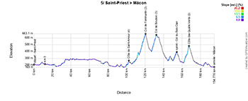
5/ Thursday June 12, 2025 - Saint-Priest > Mâcon - 183 km
The Critérium du Dauphiné 2025's 5th stage starting in Saint-Priest, just outside Lyon, is a relatively short stage on Thursday. The first 90 km of the race are fairly flat, before the riders hit the Côte de Saint-Amour (4th category, 1.2 km at 5.6%). The riders are already very close to the finishing town, but before heading there for real, they turn around again, to the west and north, to seek out 3 3rd category climbs - the Col de Fontmartin (6.7 km at 4.4%), the Col de Boubon (4.7 km at 5.2%) and the Côte des Quatre Vents (5.3 km at 4.6%) - and the intermediate sprint at Col du Bois Clair before the latter.From the last climb, it's downhill to the finish in Mâcon.
Below you'll find the itinerary, profile and OpenStreetMap of the 5th stage of the Critérium du Dauphiné 2025. Click on images to enlarge.


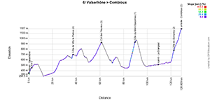
6/ Friday June 13, 2025 - Valserhône > Combloux - 126.7 km
There's no need to be superstitious for this 6th stage, which takes place on a Friday the 13th, and will be even shorter than the previous one, at just 126.7 km. On the other hand, you'll need to be a good climber, or at least enjoy climbing hills and passes, as there are no fewer than 4 on the program, before the finish at altitude. The Côte de Villy-le-Peloux (4th category, 800 m at 8.1%), the Col des Fleuries (3rd category, 5.1 km at 4.4%) and above all the La Grangeat and the Côte de Domancy (2nd category, 2.4 km at 8.6%) will spice up this stage, before the final climb to Combloux.And when we mention the Côte de Domancy and Sallanches appears on the map just before it, we're obviously thinking of the 2027 UCI World Championships circuit in Haute-Savoie, the details of which we recently presented to you and revealed the secrets of the organization of this huge event!
Below you'll find the hourly itinerary, profile and OpenStreetMap map of the route of stage 6 of the Critérium du Dauphiné 2025. Click on images to enlarge.


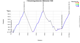
7/ Saturday June 14, 2025 - Grand-Aigueblanche > Valmeinier 1800 - 131.6 km
Stage 7 of the Critérium du Dauphiné 2025 will also be relatively short, but with its 3 outside-category passes (including the climb to the finish), it will be a real mountain stage. Right up to the start, the riders ride on the flat, but then the first outside-category climb begins, that of the Col de la Madeleine (24.6 km at 6.2%) and as soon as the descent of this one is completed, they continue very quickly on to the Col de la Croix-de-Fer (22.4 km at 6.9%). After the descent, there are just a few kilometers of false flat uphill - ending with the intermediate sprint at Saint-Michel-de-Maurienne - before the final climb begins, to Valmeinier 1800 (16.5 km at 6.7%).Below you'll find the hourly itinerary, profile and OpenStreetMap map of the route for stage 7 of the Critérium du Dauphiné 2025. Click on images to enlarge.


CONTINUE READING AFTER THIS ADVERTISEMENT
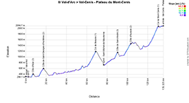
8/ Sunday June 15, 2025 - Val-d'Arc > Val-Cenis Plateau du Mont-Cenis - 133.3 km
Stage 8 of the Critérium du Dauphiné 2025 has a slightly different profile, but isn't any easier. On this stage, the riders will be going up almost the whole time, apart from the short descents of the various difficulties on the route after the start in Val-d'Arc. It all starts with a short climb, the Côte d'Aiton (3rd category, 1.2 km at 8.8%), which the riders will seek out on purpose, following the Arc river westwards before crossing it towards Aiton, finding this climb and heading eastwards back to Val-d'Arc and Aiguebelle, before going south to Saint-Jean-de-Maurienne. Soon after passing through Val-d'Arc, they will have to climb the Côte de Saint-Georges-d'Hurtières (2nd category, 4.7 km at 7.1%), while at Saint-Jean-de-Maurienne they begin the ascent of the 1st category Col de Beaune (6.6 km at 6.8%) which, after its descent, will be followed by the intermediate sprint at Saint-Michel-de-Maurienne.They then head east on a road that never stops climbing, via the Côte de Saint-André (3rd category, 2.5 km at 7.6%), Modane, the Côte d'Aussois (2nd category, 6.3 km at 6.2%), Termignon and Lanslebourg Mont-Cenis before climbing the Col du Mont-Cenis (1st category). They then follow the Lac du Mont-Cenis towards the finish in Val-Cenis - Plateau du Mont-Cenis, where the winner of the Critérium du Dauphiné 2025 will be known, succeeding Primož Roglič. We'll also know more about the state of fitness of the various riders, in preparation for the Tour de France 2025 which gets underway just 3 weeks later!
Below you'll find the time schedule, profile and OpenStreetMap map for the 8th stage of the Critérium du Dauphiné 2025. Click on images to enlarge.


The detailed route of the Critérium du Dauphiné 2025 in Google Earth
Do you prefer to open the Critérium du Dauphiné 2025 route map in Google Earth, so you can see the whole route at a glance, or take a virtual flyover over one or more stages? You can do just that, by downloading the KMZ file below (a KMZ file is a KML ZIP file, the format accepted by Google Earth):>> Download the Critérium du Dauphiné 2025 course in Google Earth (KMZ file, 883 kB)
Critérium du Dauphiné 2025 starters list
The official start list for the Critérium du Dauphiné 2025 will be published this Saturday on velowire.com!door Thomas VergouwenVond u dit artikel interessant? Laat het uw vrienden op Facebook weten door op de buttons hieronder te klikken!
2 comments | 7339 views
this publication is published in: Criterium du Dauphiné | Critérium du Dauphiné 2025 | OpenStreetMap/Google Maps/Google Earth


 by Thomas Vergouwen over
Avons nous les horaires de passage de la caravane? 2h avant le passage le + rapide j'imagine?
Bonsoir Juan,
Je ne suis pas sûr que le Critérium du Dauphiné ait une caravane publicitaire 🤷🏻.