The month of July is about to start and with that also the 109th edition of the Grande Boucle. As usual, velowire.com allows you to consult the race route maps on Open Street Maps/Google Earth of the Tour de France 2022, with all the details, but also the official time- and route schedules and the stage profiles of each of the stages, and finally a KMZ file which can be opened in Google Earth to see this Grand Tour as a whole or to do a virtual fly-over of one or more of the stages.
With the information in this article you'll be able to know all cities and all towns which will be visited by this Tour and you'll thus be able to prepare your visit of the race if you're one of the spectators on the side of the road or simply to better understand the race if you're not there!
A bit of information ...
Some precisions are important before you get to discover the detail of all the stages of the Tour de France 2022:- as for any contents on velowire.com, it is strictly forbidden to copy or reproduce in another way it's contents, as indicated on the copyright page. Please pay some respect for the time spent on preparing contents like these!
- the stage profiles have been generated automatically based on altitude informations known for the place visited by the race; there might thus be some unprecise information at some place, but the global profile is correct!
- the feeding zones of the Tour de France 2022 are forbidden for the public; therefore they are not indicated on the maps or in the time- and route schedules
The programme of the Grand start of the Tour de France 2022
As you know, the Grand start of the Tour de France 2022 will take place in Denmark, and more precisely in Copenhagen, as initially planned in 2021. Here are the dates to keep in mind for the Grand start of this Tour de France 2022:The Tour de France 2022 race route on Open Street Maps
Let's now discover in detail the Tour de France 2022 race route, stage by stage:CONTINUE READING AFTER THIS ADVERTISEMENT
1/ Friday 1st of July - Copenhague 🇩🇰 > Copenhague 🇩🇰 - individual time trial - 13.2 km
The first stage of the Tour de France 2022 will take place as an individual time trial and will thus both start and finish in Copenhagen. The start and finish location are only 500 meters apartt.The race route will be entirely in the city and on flat roads and will come by several remarkable points such as the Kastellet citadel and the famous statue of The Little Mermaid before a finish following the Tivoli park close to the Town Hall.
Hereunder you'll find the time- and route schedule, the profile and the race route on Open Street Maps for this stage. Click on the images to open them.


- start : the start will take place on the Nørre Farimagsgade in Copenhagen
- finish: Hans Christian Andersens Boulevard in Copenhagen at the end of a straight line of 600 m / width 6 m
- main cities: Copenhagen
2/ Saturday 2 July 2022 - Roskilde 🇩🇰 > Nyborg 🇩🇰 - 202,2 km
After this individual effort, the Grand Départ of the Tour de France 2022 in Denmark continues with a stage without much difficulties, which starts in Roskilde, west of Copenhagen and former capital of Denmark and the rest place for the kings and queens of the country.The riders will leave north-west via the fjords of Inderbredning, Holbæk Fjord and Lammefjord before a detour towards the north-west coast of the country to go find the Veddinge Bakker, one of the rare places in Denmark with a bit more important altitude differences.
They'll thus climb the Côte d'Asnæs Indelukke (4th category, 1.1 km @ 5.4%), the Côte d'Høve Stræde (4th category, 800 m @ 6%) and the Côte de Kårup Strandbakke (4th category, 1.3 km @ 5.8%) which summit will be reached after 84 kilometers. What follows is a visit south-west, following the coast line up to the sprint in Kalundborg before going straight south following the west coast of the country where the peloton could break up in parts because of the wind.
When they get to Korsør the difficulties with the wind will not be over yet because they turn right there to get onto the Storebælt bridge (Grand Belt) which is no less than 18 kilometers long and which brings them directly towards the finish city of Nyborg "riding on the sea", just like in 2015 with the finish in the province of Zealand in The Netherlands.
Hereunder you'll find the time- and route schedule, the profile and the race route on Open Street Maps for this stage. Click on the images to open them.


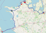
- start: the start will take place on the Sankt Clara Vej in Roskilde (12.15PM), with the official start ceremony (since this is the first stage in line of the Tour de France 2022) on Stændertorvet immediately afterwards (12.29PM) followed by the kilometer zero on the Østre Ringvej (O2), after 5.5 km of neutralised road
- climbs:
- Côte d'Asnæs Indelukke (4th category) at km 62 - 1.1 km @ 5.4%
- Côte d'Høve Stræde (4th category) at km 72,5 - 800 m @ 6%
- Côte de Kårup Strandbakke (4th category) at km 84 - 1.3 km @ 5.8% - intermediate sprint: Elmegade in Kalundborg at km 126.9
- finish: Storebæltsvej in Nyborg at the end of a straight line of 800 m of which 300 m visible / width 6.5 m
- main cities: Roskilde, Holbæk, Kalundborg, Korsør and Nyborg
3/ Sunday 3 July 2022 - Vejle 🇩🇰 > Sønderborg 🇩🇰 - 182 km
The 3rd and last stage of the Grand Départ of the Tour de France 2022 in Denmark will start in Vejle.Around this start city, the organisors went of to find a minimum of hilly terrain, but there's only one real climb, with an altitude of 55 meters, which can be found there, the Côte de Koldingvej, which is just south of the start but which will be on the race route after a little bit over 27 kilometers thanks to a detour north-west of the start.
The race then continues south, via Kolding, the Côte Hejlsminde Strand and the intermediate sprint of Christiansfeld. Continuing south, the riders will climb the Côte de Genner Strand and continue down to Aabenraa where the race route will turn south-east towards the finish in Sønderborg, close to the border with Germany, where the sprinters teams will have done all they could to see this stage end in a bunch sprint.
Hereunder you'll find the time- and route schedule, the profile and the race route on Open Street Maps for this stage. Click on the images to open them.


- start: the start will take place on the Strandgade in Vejle followed by the kilometer zero on Jellingvej, after 4.1 km of neutralised road
- climbs:
- Côte de Koldingvej (4th category) at km 27.3 - 1.1 km @ 3.4%
- Côte de Hejlsminde Strand (4th category) at km 82.8 - 800 m @ 5.5%
- Côte de Genner Strand (4th category) at km 123.3 - 1,7 km @ 3.4% - intermediate sprint: Allervej in Christiansveld at km 90.5
- finish: Augustenborg Landevej in Sønderborg at the end of a straight line of 750 m / width 7 m
- main cities: Vejle, Kolding, Christiansveld, Haderslev, Aabenraa and Sønderborg
T/ Monday 4 July 2022 - transfer towards Lille
After these 3 days of the most northern Grand Départ in the history of the Tour de France, this Monday 4 July is reserved for the transfer towards the north of France, and more precisely towards Lille, even though this will actually be done for the riders the night before and this is thus in some way an extra rest day.CONTINUE READING AFTER THIS ADVERTISEMENT
4/ Tuesday 5 July 2022 - Dunkerque > Calais - 171.5 km
The 4th stage, the first of this Tour de France 2022 which will take place in France, will start in Dunkirk where the Tour will make its comeback for the first time since 2007, and it'll be the 20th time in its history. This stage will take place from one location on the sea side to another, Calais (two cities which are almost neighbours), but that doesn't mean the race route will be completely flat. Indeed, this stage will go find both the Flanders mounts as the Boulonnais mounts, to get to a total of 6 difficulties. This height difference, combined with a risk of wind in the final when the riders get close to cap Griz-Nez and cap Blanc-Nez, might lead to a stage which will not end in a bunch sprint but see a small group resist until the finish!Hereunder you'll find the time- and route schedule, the profile and the race route on Open Street Maps for this stage. Click on the images to open them.


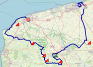
- start : the start will take place on the Place du Centenaire in Dunkirk followed by the kilometer zero on the D79, after 6.9 km of neutralised road
- climbs:
- Côte de Cassel (4th category) at km 30.7 - 1.7 km @ 4.2%
- Côte de Remilly-Wirquin (4th category) at km 71.8 - 1.1 km @ 6.8%
- Côte de Nielles-lès-Bléquin (4th category) at km 97.2 - 1.1 km @ 7.7%
- Côte de Harlettes (4th category) at km 102.7 - 1.3 km @ 6%
- Côte du Ventus (4th category) at km 123.6 - 1.1 km @ 4.8%
- Côte du Cap Blanc Nez (4th category) at km 160.7 - 900 m @ 7.5% - intermediate sprint: Avenue Bernard Chochoy in Lumbres at km 63,2
- finish: Avenue Pierre de Coubertin in Calais at the end of a straight line of 500 m / width 7 m
- visited departments : Nord (59) from km 0 till km 40, Pas-de-Calais (62) from km 48.4 till km 171.5
- main cities: Dunkerque, Saint-Omer and Calais
5/ Wednesday 6 July 2022 - Lille > Arenberg Porte du Hainaut - 157 km
The 5th stage will be a small Paris-Roubaix, starting in Lille.It'll contain no less than 11 cobble stones sections of which 5 have never before been visited, neither by the Tour de France nor by Paris-Roubaix, for a total distance of 19.4 km, before a finish in Arenberg Porte du Hainaut.
Hereunder you'll find the time- and route schedule, the profile and the race route on Open Street Maps for this stage. Click on the images to open them.


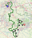
- start: the start will take place in the Rue Georges Lefebvre at the foot of the Grand Palais in Lille followed by the kilometer zero on the M660 / avenue de Flandre in Wasquehal, after 13.4 km of neutralised road
- cobble stones sections: here are the cobble stones sections and their classification (** = quite easy, *** = difficult, **** = very difficult)
- 11/ Fressain to Villers-au-Tertre *** at km 79.7 - 1400 m
- 10/ Eswars to Paillencourt ** at km 100.6 - 1,600 m
- 9/ Wasnes-au-Bac to Marcq-en-Ostrevent *** at km 106.5 - 1,400 m
- 8/ Emerchicourt to Monchecourt *** at km 110.9 - 1,600 m
- 7/ Auberchicourt to Emerchicourt *** at km 114.1 - 1,300 m
- 6/ Abscon ** at km 119.6 - 1,500 m
- 5/ Erre to Wandignies-Hamage **** at km 126.7 - 2,800 m
- 4/ Warlaing to Brillon *** at km 133.4 - 2,400 m
- 3/ Tilloy-lez-Marchiennes to Sars-et-Rosières **** at km 136.9 - 2,400 m
- 2/ Bousignies to Millonfosse *** at km 143.4 - 1,400 m
- 1/ Hasnon to Wallers *** at km 150.3 - 1,600 m - intermediate sprint: D917 in Mérignies at km 37.2
- finish: Avenue Michel Rondet (D313) in Arenberg at the end of a straight line of 850 m / width 5.5 m
- visited departments : Nord (59) from km 0 till km 157
- main cities: Lille, Templeuve-en-Pévèle and Arenberg
6/ Thursday 7 July 2022 - Binche 🇧🇪 > Longwy - 219,9 km
The 6th stage will offer a short excursion in Belgium, the third of the 4 countries which will be visited by the Tour de France 2022. More precisely, it'll start in Binche, like in 2019 when a stage started there towards Epernay. In 2022 it'll be towards Longwy that the riders will go, in the longest stage of this Tour de France 2022. At 6 kilometers from the finish they will however find quite some difficulty, with the steep wall which forms the Côte de Pulventeux (800 m @ 12.3%), immediately followed by the Côte des Religieuses (1.6 km @ 5.8%) where the finish line will be drawn.Hereunder you'll find the time- and route schedule, the profile and the race route on Open Street Maps for this stage. Click on the images to open them.


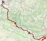
- start : the start will take place on the Avenue Wanderpepen in Binche (BE) followed by the kilometer zero on the N55, after 4.9 km of neutralised road
- climbs:
- Côte des Mazures (3rd category) at km 87.2 - 2 km @ 7.6%
- Côte de Montigny-sur-Chiers (4th category) at km 205 - 1.7 km @ 4.4%
- Côte de Pulventeux (3rd category) at km 214.6 - 800 m à 12.3%
- Côte des Religieuses (4th category) at km 219.9 - 1.6 km @ 5.8% - intermediate sprint: Avenue du Général de Gaulle in Carignan at km 145.9
- finish: Côte des Religieuses in Longwy after a 1.6 km long climb @ 5.8%
- visited departments : Hainaut (Belgium) from km 0 till km 32.6 and from km 50.7 till km 67.8, Namur (Belgium) from km 35.8 till km 36.9 and at km 69.2, Ardennes (08) from km 69.4 till km 159.9, Meuse (55) from km 162.2 till km 183.6, Meurthe-et-Moselle (54) from km 184.7 till km 219.9
- main cities: Binche (BE), Charleville-Mézières, Sedan, Longuyon et Longwy
7/ Friday 8 July 2022 - Tomblaine > La Super Planche des Belles Filles - 176.3 km
For the 3rd time in history, Tomblaine will see a stage start of the Tour de France, after 2012 and 2014. From there, the riders will be off to the Vosges department and more precisely La super Planche des Belles Filles, which means the finish at la Planche des Belles Filles continued on a half-paved road, which was built in 2019. This will be the first altitude finish of this Tour but we can't really call this a mountain stage because even though the race route is more than hilly (and la Planche is preceded by two other climbs [the Col de Grosse Pierre and the Col des Croix), what will be most important is the out-of-the-blue climb of la Planche des Belles Filles at the end of the stage.Hereunder you'll find the time- and route schedule, the profile and the race route on Open Street Maps for this stage. Click on the images to open them.

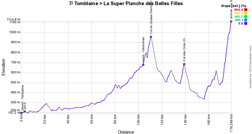

- start: the start will take place in the Rue Jean Moulin in Tomblaine followed by the kilometer zero on the D79, after 6.9 km of neutralised road
- climbs:
- Col de Grosse Pierre (3rd category) at km 107.7 - 3.1 km @ 6.4%
- Col des Croix (3rd category) at km 136,1 - 3.2 km @ 6.3%
- La super Planche des Belles Filles (1st category) at km 176.3 - 7 km @ 8.7% - intermediate sprint: Rue du 152 Régiment in Gérardmer at km 101.2
- finish: D16E at La super Planche des Belles Filles after a climb of 7 km @ 8.7%, at the end of a straight line of visibility of 100 m / width 5.5 m
- visited departments : Meurthe-et-Moselle (54) from km 0 till km 45.9, Vosges (88) from km 47.4 till km 136,1, Haute-Saône (70) from km 139.9 till km 176.3
- main cities: Tomblaine, Lunéville, Gérardmer, La Bresse, Cornimont and Plancher-les-Mines
CONTINUE READING AFTER THIS ADVERTISEMENT
8/ Saturday 9 July 2022 - Dole > Lausanne 🇨🇭 - 186,3 km
On Saturday 9 July the 8th stage of the Tour de France 2022 will start in Dole in the Jura department, the city where Louis Pasteur was born 200 years back in time. Indeed, the inventor of the rabbies shot was born here in 1822 and in 2022 we can thus celebrate his 200th birthday, without however being able to celebrate the end of the Covid-19 pandemic!.This stage will go off to Switzerland, the 4th country which is visited by this Tour de France 2022, and more precisely to Lausanne, and once the riders have come by the main offies of the International Olympic Committee (IOC) at 10 kilometers from the finish, the finish itself will be judged in fron of the Olympic Stadium after a final climb of 4.8 km @ 4.6% containing a part at 12%!
Hereunder you'll find the time- and route schedule, the profile and the race route on Open Street Maps for this stage. Click on the images to open them.

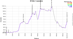
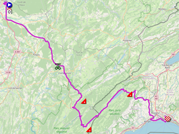
- start : the start will take place from the Esplanade du Champ de Fêtes in Dole followed by the kilometer zero on the D405, after 7.5 km of neutralised road
- climbs:
- Côte du Maréchet (4th category) at km 75.6 - 2 km @ 5.7%
- Côte des Rousses (3rd category) at km 107.6 - 6.7 km @ 5%
- Col de Pétra Félix (4th category) at km 139.1 - 2.4 km @ 1.5% - intermediate sprint: Rue Pasteur in Montrond at km 46.9
- finish: Côte du Stade Olympique / Route des Plaines-du-Loup in Lausanne after a 4.8 km climb @ 4.6%, at the end of a straight line of 600 m (of which 300 m visible) / width 6.5 m
- visited departments : Jura (39) from km 0 till km 107.6, Canton de Vaud (Switzerland) from km 113.6 till km 186.3
- main cities: Dole, Arbois, Champagnole, Les Rousses and Lausanne (Switzerland)
9/ Sunday 10 July 2022 - Aigle 🇨🇭 > Châtel Les Portes-du-Soleil - 192.9 km
On this Sunday we'll leave Switzerland, but not that quickly after the start from Aigle, the city where the International Cycling Union (UCI) offices are since 2002, because after having followed the Léman Lake in the middel of the wineyards, a loop of about 150 kilometers will be on the programme in the cantons of Vaud, Valais and Fribourg, getting on the climb of the Col des Mosses (1,445 m) just after halfway in the stage, and a bit further the more difficult climb of the Col de la Croix (1,778 m) before returning back downwards to Aigle after which the riders will finally go off to France via the climb of the Pas de Morgins (1,377 m). After its descent it's slightly uphill again, towards the finish in Châtel, station of the Portes du Soleil ski area, of which the mayor Nicolas Rubin has been waiting for the comeback of the Tour since his first election in 2008 while the Tour is now coming for the 2nd time, after a time trial between Morzine and Châtel in 1975! In total, this real first Alps stage will show a 3,600 meters uphill height difference.Hereunder you'll find the time- and route schedule, the profile and the race route on Open Street Maps for this stage. Click on the images to open them.

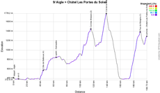
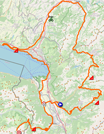
- start: the start will take place from the Avenue Chevron in Aigle (Switzerland) followed by the kilometer zero on the Route du Léman (route 21) in Vionnaz, after 7.5 km of neutralised road
- climbs:
- Côte de Bellevue (4th category) at km 37.1 - 4.3 km @ 4%
- Col des Mosses (2nd category) at km 108.5 - 13.3 km @ 4.1%
- Col de la Croix (1st category) at km 131.8 - 8.1 km @ 7.6%
- Pas de Morgins (1st category) at km 183.1 - 15.4 km @ 6.1% - intermediate sprint: Grand Rue in Semsales at km 56.5
- finish: D228A / route de Pré-la-Joux in Châtel (Pré-la-Joux) at the end of a straight line of 170 m in line of view / width 6 m
- visited departments : Canton du Valais (Switzerland) from km 0 till km 3.5 and from km 160 till km 183.1, Canton de Vaud (Switzerland) from km 4 till km 49.9 and from km 86.5 till km 159.5, Canton de Fribourg (Switzerland) from km 50 till km 86.1, Haute-Savoie (74) from km 185 till km 192.9
- main cities: Aigle (Switzerland), Montreux, La Tour-de-Peilz, Vevey, Bulle, Aigle, Monthey and Châtel
R1/ Monday 11 July 2022 - rest day in Morzine
After this 9th stage, the riders and followers of the Tour de France 2022 will stay in the Portes du Soleil ski area, to get some rest in Morzine.10/ Tuesday 12 July 2022 - Morzine Les Portes-du-Soleil > Megève - 148,1 km
Once they've taken some rest, still in the Portes du Soleil ski area, the riders get back to the race for the 10th stage which will return to Morzine for its start. Morzine which saw the Tour de France already 20 times before. The destination will be another ski station, Megève, but even though this stage thus takes place in a mountaineous setting, it'll not be a mountain stage because the race route which has been drawn to be completely in the Haute-Savoie department shows, apart from the final climb towards the Megève altiport (1,382 m) and the finish line at an altitude of 1,460 m, a quite reasonable uphill height difference!Hereunder you'll find the time- and route schedule, the profile and the race route on Open Street Maps for this stage. Click on the images to open them.

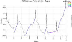

- start: the start will take place from the Route du Plan in Morzine followed by the kilometer zero on the D902, after 5.4 km of neutralised road
- climbs:
- Côte de Chevenoz (4th category) at km 24.1 - 2.2 km à 2.9%
- Col de Jambaz (3rd category) at km 69.2 - 6.7 km @ 3.8%
- Côte de Châtillon-sur-Cluses (4th category) at km 97.3 - 4.5 km @ 3.9%
- Montée de l'altiport de Megève (2nd category) at km 145.9 - 19.2 km @ 4.1% - intermediate sprint: Avenue de Saint-Martin in Passy-Marlioz at km 123.8
- finish: Altiport de Megève in Megève, at the end of a straight line of 580 m / width 7 m
- visited departments : Haute-Savoie (74) from km 0 till km 148.1
- main cities: Morzine, Thonon-les-Bains, Cluses and Megève
CONTINUE READING AFTER THIS ADVERTISEMENT
11/ Wednesday 13 July 2022 - Albertville > Col du Granon Serre Chevalier - 151,7 km
After having visited the Olympic capital (Lausanne) a few days before, the Tour de France returns to the Olympic city of Albertville. Albertville is maybe one of the cities which has the highest number of visits of the Tour de France in the past few years. In a few years, Albertville collects the Tour de France visits because, while in the history of the Tour it'll be only the 7th time, Albertville has seen no less than 4 stage starts these 6 past years (2016, 2018, 2019 and 2021) and we now add the 5th out of 7 years this year!!This time it'll be a real Alps stage which awaits the riders from this Olympic city. A relatively short stage with its 151.7 kilometers but in which we find right at the end of the first third of the stage the climb of the Lacets de Montvernier (782 m) and after a visit of Saint-Jean-de-Maurienne and Saint-Michel-de-Maurienne the riders attack the following climbs of the Col du Télégraphe (1,566 m) and Col du Galibier (2,642 m), which makes its comeback since 2017 and thus has the honours to award the Souvenir Henri Desgrange to the first rider arriving there on top. We'll than be at 45 kilometers from the finish and after a long descent the riders will still have to do the final climb towards the finish on top of the Col du Granon (2,413 m) where the Tour returns only for the 2nd time for a finish since the one in 1986. This stage thus represents a climbing height difference of 4000 meters.
Hereunder you'll find the time- and route schedule, the profile and the race route on Open Street Maps for this stage. Click on the images to open them.

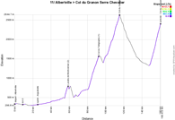

- start: the start will take place at the Parc Olympique Henry Dujol in Albertville followed by the kilometer zero on the D925, after 8.8 km of neutralised road
- climbs:
- Lacets de Montvernier (2nd category) at km 49.9 - 3.4 km @ 8.2%
- Col du Télégraphe (1st category) at km 83.8 - 11.9 km @ 7.1%
- Col du Galibier (hors category) at km 106.7 - 17.7 km @ 6.9%
- Col du Granon Serre Chevalier (outside category) at km 151.7 - 11.3 km @ 9.2% - intermediate sprint: Grande Rue in Aiguebelle at km 16.5
- finish: D234 on the Col du Granon, after a 11.3 km climb @ 9.2% and at the end of a straight line of 100 m / width 5 m
- visited departments : Savoie (73) from km 0 till km 106.7, Hautes-Alpes (05) from km 107.6 till km 151.7
- main cities: Albertville, Saint-Jean-de-Maurienne and Saint-Michel-de-Maurienne
12/ Thursday 14 July 2022 - Briançon > Alpe d'Huez - 165.1 km
On this national bank holiday, after the start in Briançon, the riders will first follow the route of the previous stage in the oppositie direction via the Col du Galibier (2,642 m), its descent towards Valloire followed by the Col du Télégraphe and further on till Saint-Michel-de-Maurienne and Saint-Jean-de-Maurienne, before they go find the long climb of the Col de la Croix de Fer (2,067 m). Via the barrage de Grand'Maison the stage descends towards Allemond and goes on till Le Bourg d'Oisans, at the foot of the final climb, the famous 21 numbered bends of the Alpe d'Huez (1,850 m).This stage is the one which represents the highest uphill height difference in this Tour de France 2022, 4750 meters, and it'll be an exact copy of the stage between Briançon and the Alpe d'Huez in 1986 when Bernard Hinault and Greg Lemond crossed the finish line together.
Hereunder you'll find the time- and route schedule, the profile and the race route on Open Street Maps for this stage. Click on the images to open them.

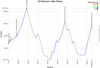
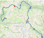
- start: the start will take place in the Avenue Jean Moulin in Briançon followed by the kilometer zero on the D1091, after 4.6 km of neutralised road
- climbs:
- Col du Galibier (outside category) at km 33.2 - 23 km @ 5.1%
- Col de la Croix de Fer (outside category) at km 110.6 - 29 km @ 5.2%
- Alpe d'Huez (outside category) at km 165.1 - 13.8 km @ 8.1% - intermediate sprint: D1091/Route de Grenoble in Le Monêtier-les-Bains at km 11.8
- finish: Avenue du Rif Nel at Alpe d'Huez, after a 13.8 km climb @ 8.1% and at the end of a straight line of 220 m in sight / width 6 m
- visited departments : Hautes-Alpes (05) from km 0 till km 33.2, Savoie (73) from km 37.1 till km 165.1
- main cities: Briançon, Le Monêtier-les-Bains, Saint-Michel-de-Maurienne, Saint-Jean-de-Maurienne, Le Bourg d'Oisans and Alpe d'Huez
13/ Friday 15 July 2022 - Le Bourg d'Oisans > Saint-Etienne - 192.6 km
Almost as usual the day after a finish on the Alpe d'Huez, this 13th stage will start from Le Bourg d'Oisans and will be some sort of transition stage, made for sprinters, with - after a visit of Grenoble - its main difficulty being the Col de Parménie (571 m) àjust after mid-stage.In Saint-Etienne, the finish line will be drawn at the Geoffroy-Guichard stadion (which is nicknamed Le Chaudron).
Hereunder you'll find the time- and route schedule, the profile and the race route on Open Street Maps for this stage. Click on the images to open them.

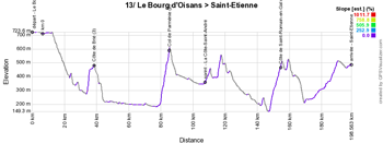
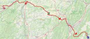
- start: the start will take place in the Avenue de la Gare / Avenue de la République in Le Bourg d'Oisans followed by the kilometer zero on the D1091, after 6.7 km of neutralised road
- climbs:
- Côte de Brié (3rd category) at km 30.4 - 2.4 km @ 6.9%
- Col de Parménie (2nd category) at km 79.2 - 5.1 km @ 6.6%
- Côte de Saint-Romain-en-Gal (3rd category) at km 148.6 - 6.6 km @ 4.5% - intermediate sprint: Avenue Hector Berlioz in La Côte-Saint-André at km 101.6
- finish: Rue Claude Verney-Carron in Saint-Etienne, at the end of a straight line of 800 m (of which 350 m in sight)
- visited departments : Isère (38) from km 0 till km 136, Rhône (69) from km 140.7 till km 160.8 and from km 164.2 till km 164.6, Loire (42) at km 163.5 and from km 165.3 till km 192.6
- main cities: Bourg d'Oisans, Grenoble, Vienne, Rive-de-Gier, Saint-Chamond and Saint-Etienne
14/ Saturday 16 July 2022 - Saint-Etienne > Mende - 192.5 km
Saint-Etienne will also be a start city, of this 14th stage, and this time it'll be a hilly stage, which will be ended off by the Côte de la Croix Neuve which is also called the Jalabert Climb (since he was the first to win here in 1995), for a finish at the Mende-Brénoux airfield.Hereunder you'll find the time- and route schedule, the profile and the race route on Open Street Maps for this stage. Click on the images to open them.

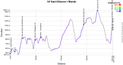
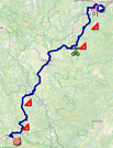
- start: the start will take place in the Rue Paul et Pierre Guichard in Saint-Etienne followed by the kilometer zero on the M3.2 in Roche-la-Molière, after 9.2 km of neutralised road
- climbs:
- Côte de Saint-Just-Malmont (3rd category) at km 14.2 - 7.7 km @ 3.9%
- Côte de Châtaignier (3rd category) at km 39.1 - 2.6 km @ 7.3%
- Côte de Grandrieu (3rd category) at km 135.3 - 6.3 km @ 4.1%
- Côte de la Fage (3rd category) at km 162.1 - 4.2 km @ 6% - intermediate sprint: Avenue du 8 mai 1945 in Yssingeaux at km 50.7
- finish: Piste de l'aérodrome de Mende-Brenoux in Mende, at the end of a straight line of 470 m / width 7 m
- visited departments : Loire (42) from km 0 till km 5.4, Haute-Loire (43) from km 13.1 till km 120.1, Lozère (48) from km 120.3 till km 192.5
- main cities: Saint-Etienne, Yssingeaux, Le Puy-en-Velay and Mende
CONTINUE READING AFTER THIS ADVERTISEMENT
15/ Sunday 17 July 2022 - Rodez > Carcassonne - 202.5 km
The start of the 15th stage will be in Rodez in the Aveyron department, the city of Pierre Soulages, a famous painter.Just like two days before, it'll most probably again be a stage which finishes in a bunch sprint, while usually the stages which finish in Carcassonne are more likely made for a breakaway group. Carcassonne is a stage city for the 12th time already in 2022 and goes up real fast in the previous years with visits in 2014 (start), 2016 (start), 2018 (finish, rest day and start), 2021 (finish and start).
Hereunder you'll find the time- and route schedule, the profile and the race route on Open Street Maps for this stage. Click on the images to open them.


- start: the start will take place from the Boulevard Gambetta in Rodez followed by the kilometer zero on the D888, after 4.7 km of neutralised road
- climbs:
- Côte d'Ambialet (3rd category) at km 68.9 - 4.4 km @ 4.6%
- Côte des Cammazes (3rd category) at km 154.6 - 5.1 km @ 4.1% - intermediate sprint: Avenue de la Plage in Saint Ferréol at km 147
- finish: Boulevard Marcou in Carcassonne, at the end of a straight line of 200 m in sight / width 6 m
- visited departments : Aveyron (12) from km 0 till km 45.5, Tarn (81) from km 47.8 till km 139.1, Haute-Garonne (31) from km 147.1 till km 155.8, Aude (11) from km 163.8 till km 202.5
- main cities: Rodez, Réalmont, Puylaurens, Revel and Carcassonne
R2/ Monday 18 July 2022 - rest day in Carcassonne
This last rest day will allow the riders to get some forces in Carcassonne.16/ Tuesday 19 July 2022 - Carcassonne > Foix - 178.5 km
After this rest day, the start will also be in Carcassonne for this 16th stage which announced the start of the 3rd and last week of racing in the Tour de France 2022.And that'll be for an entrance in the Pyrenees area, with two difficulties in the last part of the stage, starting with the Port de Lers (1,517 m) which summit will be reached on kilometer 125.1 and after its descent the riders will start the climb of the Mur de Péguère (1,375 m) after which they'll have 27.2 kilometers downhill left until the finish in Foix. It's thus easy to say that in order to win this stage a rider must be a good climber, but first of all also a good descender!
Hereunder you'll find the time- and route schedule, the profile and the race route on Open Street Maps for this stage. Click on the images to open them.

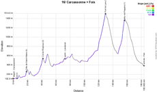
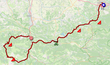
- start: the start will take place from the Place du Général de Gaulle in Carcassonne followed by the kilometer zero on the D104, after 5.4 km of neutralised road
- climbs:
- Côte de Saint-Hilaire (4th category) at km 13.7 - 1.5 km @ 6.6%
- Col de l'Espinas (3rd category) at km 36.6 - 5.3 km @ 5%
- Port de Lers (1st category) at km 125.1 - 11.4 km @ 7%
- Mur de Péguère (1st category) at km 151.3 - 9.3 km @ 7.9% - intermediate sprint: Avenue Général de Gaulle in Lavelanet at km 67.8
- finish: Allée de Villote in Foix, at the end of a straight line of 180 m / width 5.5 m
- visited departments: Aude (11) from km 0 till km 51.8 and at km 54.1, Ariège (09) from km 52.7 till km 53.2 and from km 58.7 till km 178.5
- main cities: Carcassonne, Limoux, Lavelanet, Tarascon-sur-Ariège and Foix
17/ Wednesday 20 July 2022 - Saint-Gaudens > Peyragudes - 129,7 km
A real Pyrenean stage, short but dense in difficulties, will be on the programme this Wednesday 20 July 2022, with a start in Saint-Gaudens which will see the Tour de France come by for the 16th time already, the last time for a stage finish in 2021!While the first half of the stage is quite easy, the Col d'Aspin (1,490 m) will be the first difficulty the riders will find on their road and things will follow up on each other rapidly from there, with the Hourquette d'Ancizan (1,564 m) and after its descent till Saint-Lary-Soulan the Col de Val Louron-Azet (1,580 m). After the descent towards Loudenvielle and its lake, the riders won't be at the end of what makes this stage difficult because they'll still have the final climb to do, towards Peyragudes (1,580 m), which presents an average steepness of 7.8% over 8 km, and a final part at 16%. The finish will be at the altiport, where the James Bond movie "Tomorrow never dies" was filmed in 1997. This stage will have an uphill height difference of 3,300 meters.
Hereunder you'll find the time- and route schedule, the profile and the race route on Open Street Maps for this stage. Click on the images to open them.

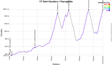
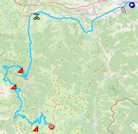
- start: the start will take place in the Rue des Compagnons du Tour de France in Saint-Gaudens followed by the kilometer zero on the D8, after 3.5 km of neutralised road
- climbs:
- Col d'Aspin (1st category) at km 65.7 - 12 km @ 6.5%
- La Hourquette d'Ancizan (2nd category) at km 81.6 - 8.2 km @ 5.1%
- Col de Val Louron-Azet (1st category) at km 109.5 - 10.7 km @ 6.8%
- Peyragudes (1st category) at km 129.7 - 8 km @ 7.8% - intermediate sprint: Avenue de l'Eglise in La Barthe-de-Neste at km 32.9
- finish: Piste de l'altiport de Peyresourde-Balestas in Peyragudes, after an 8 km climb @ 7.8% and at the end of a straight line of 400 m (of which 100 m in sight) / width 6.5 m
- visited departments : Haute-Garonne (31) from km 0 till km 13.7, Hautes-Pyrénées (65) from km 16.6 till km 129.7
- main cities: Saint-Gaudens, La Barthe-de-Neste, Arreau and Saint-Lary-Soulan
CONTINUE READING AFTER THIS ADVERTISEMENT
18/ Thursday 21 July 2022 - Lourdes > Hautacam - 143.2 km
For the 18th stage of the Tour de France 2022 we could have returned to Pau as the usual suspect on the map of the Tour de France for the 73rd time in 2021, but this time it'll be the city of Lourdes which was chosen and, like in 2018, the start will take place from the Sanctuary, for this Pyrenean stage.Until Laruns, no single rider will have any difficulties in following the race, but after about sixty kilometers things get more difficult when they arrive on the climb of the Col d'Aubisque (1,709 m). After the Col du Soulor, they'll descend towards Ferrières and immediately go on with the Col de Spandelles, which will be part of the Tour de France race route for the very first time! A descent and a visit of Argelès-Gazost later, the riders will start the final climb towards Hautacam.
Hereunder you'll find the time- and route schedule, the profile and the race route on Open Street Maps for this stage. Click on the images to open them.

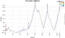
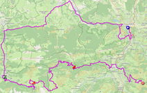
- start: the start will take place from the Place Monseigneur Laurence in Lourdes followed by the kilometer zero on the D921B, after 3.1 km of neutralised road
- climbs:
- Col d'Aubisque (outside category) at km 76.7 - 16.4 km @ 7.1%
- Col de Spandelles (1st category) at km 110 - 10.3 km @ 8.3%
- Hautacam (outside category) at km 143.2 - 13.6 km @ 7.8% - intermediate sprint: Avenue de la Gare in Laruns at km 58.5
- finish: D100 at Hautacam, after a 13.6 km climb @ 7.8% and at the end of a straight line of 100 m in sight / width 5.5 m
- visited departments : Hautes-Pyrénées (65) from km 0 till km 20.3 and from km 86.3 till km 143.2, Pyrénées-Atlantiques (64) from km 21.5 till km 83.2
- main cities: Lourdes, Laruns and Argeles-Gazost
19/ Friday 22 July 2022 - Castelnau-Magnoac > Cahors - 188.3 km
In the small town of Castelnau-Magnoac (800 inhabitants), at the north of the Hautes-Pyrénées department, the riders will gather together for the start of the 20th stage of this Tour de France 2022.It'll be a flat stage with a quite hilly final part though, which comes by the château de Cayx, propriety of the Danish royal familly, which thus remembers of the the start of this quite international Tour. Difficult to say whether this stage will be for a sprinter or a breakaway rider, we'll be sure about that on Friday 22 July 2022 at the end of the afternoon at the finish in Cahors!
Hereunder you'll find the time- and route schedule, the profile and the race route on Open Street Maps for this stage. Click on the images to open them.


- start: the start will take place in the Rue de la Tour in Castelnau-Magnoac followed by the kilometer zero on the D929, after 2.3 km of neutralised road
- climbs:
- Côte de la Cité médiévale de Lauzerte (4th category) at km 135.7 - 2 km @ 6.2%
- Côte de Saint-Daunès (4th category) at km 152.6 - 1.6 km @ 6.3% - intermediate sprint: Avenue des Pyrénées in Auch at km 38.4
- finish: Boulevard Léon Gambetta in Cahors, at the end of a straight line of 900 m (of which 300 m in sight) / width 6 m
- visited departments : Hautes-Pyrénées (65) from km 0 till km 2.3, Gers (32) from km 3.6 at km 78.9, Tarn-et-Garonne (82) from km 83.5 till km 142, Lot (46) from km 147.2 till km 188.3
- main cities: Auch, Valence and Cahors
20/ Saturday 23 July 2022 - Lacapelle-Marival > Rocamadour - individual time trial - 40.7 km
The usual individual time trial the day before the finish in Paris will this year start in another small village, Lacapelle-Marival.This solitary effort will entirely take place in the Lot department, over a quite important distance of 40.7 kilometers. After the intermediate timing points in Aynac, Gramat and Couzou, two hills will accompany the final pedal strokes of the riders, the Côte de Magès at 4 km from the finish and the Côte de l'Hospitalet at 300 meters from the finish. These hills bring each rider at the level of Rocamadour which is troning over the valley.
Hereunder you'll find the time- and route schedule, the profile and the race route on Open Street Maps for this stage. Click on the images to open them.


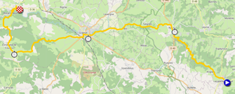
- start: the start ramp will be in the Rue Merlival in Lacapelle-Marival
- intermediate timing points:
- Aynac at km 10.6
- Gramat at km 22.1
- Couzou at km 32.6 - finish: D673 in Rocamadour, at the end of a straight line of 130 m / width 5.5 m
- visited departments : Lot (46) from km 0 till km 40.7
- main cities: Gramat and Rocamadour
21/ Sunday 24 July 2022 - Paris La Défense Arena > Paris Champs-Elysées - 115.6 km
Despite the contract with the Yvelines (78) department which mentioned a stage start in this department until 2023 and thanks to a new sponsorship by the Hauts-de-Seine (92) department, the last stage of the Tour de France 2022 will start from the Paris La Défense ArenaParis and its famous Champs-Elysées. The start of this stage will take place from inside the Défense Arena. Even though the start won't take place there, it does visit the Yvelines department for quite some time before entering Paris via the Jardin du Luxembourg and the Île de la Cité via the Pont Neuf and a visit of the Cour carrée du Louvre to finally get on the Champs-Elysées, turn around the Arc de Triomphe as it has done every year since 2013 and do the usual 8 laps of the circuit via the Rue de Rivoli and the final sprint on the Champs.Hereunder you'll find the time- and route schedule, the profile and the race route on Open Street Maps for this stage. Click on the images to open them.


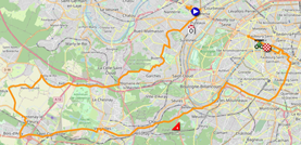
- start: the start will take place from inside the Paris La Défense Arena followed by the kilometer zero on the Route des Fusillés de la Résistance (D5) in Puteaux, after 4.3 km of neutralised road
- climbs:
- Côte du Pavé des Gardes (4th category) at km 43.3 - 1.3 km @ 6.5% - intermediate sprint: Haut des Champs-Elysées in Paris at the 3rd crossing, at km 75.5
- finish: Avenue des Champs-Elysées in Paris, at the end of a final straight line of 700 m and after 8 laps on a 6.8 km circuit / width 6 m
- visited departments : Hauts-de-Seine from km 0 till km 10 and from km 41.6 till km 46.7, Yvelines (78) from km 13.5 till km 39.6, Paris from km 49.6 till km 115.6
- main cities: La Défense, Garches, Bois d'Arcy, Saint-Cyr-l'Ecole, Versailles, Issy-les-Moulineaux and Paris
The Tour de France 2022 race route in Google Earth
Do you prefer to see the global picture with all stages of the Tour de France 2022 on one single map? Or would you like to do a virtual fly-over over one or more of the stages of this 109th edition of the Tour de France? That's all possible by downloading the KMZ file (a compressed KML file, because of its size) below and opening it with Google Earth (please make sure you choose the "desktop" version of Google Earth; it won't work in the online version of Google Earth)! WARNING - copyright: despite the fact this KMZ/KML file is provided for your own use, you must keep in mind it is strictly forbidden to reproduce the contents of this KMZ/KML file or of any other file (including the maps, the stage profiles, the KML files and others) which make up the Tour de France 2022 as provided by velowire.com. These contents are indeed protected by copyright and I ask you to respect this, especially because the huge amount of time it takes to prepare these contents. This protection is for the reproduction of the maps and all other elements in any form (as a map, videos which do the fly-over of the stages or any other creation based on the contents provided by velowire.com).
>> Download the race route of all Tour de France 2022 stages in Google Earth (KMZ file; IMPORTANT: if the download doesn't start, copy the link and paste it in a new window of your navigator and push enter)

Vond u dit artikel interessant? Laat het uw vrienden op Facebook weten door op de buttons hieronder te klikken!
11 comments | 31096 views
this publication is published in: Tour de France | Tour de France 2022 | OpenStreetMap/Google Maps/Google Earth


 by Thomas Vergouwen over
- from 2PM till 9PM: opening of the Fan Park - Kongens Nytorv - free entrance
- from 5.45PM till 8.10PM: teams presentation of the Tour de France 2022 at Tivoli, preceded by a parade by bike which is 1.5 km long and which will allow the riders to get from the cycling bridge Lille Langebro and following Vester Voldgade up to the Town Hall place and finally Jernbanegade to Axeltorv, where they access Tivoli and the presentation on the podium, before they get off the podium and leave the park.